Category Archives: Hikes

Sugarloaf and the Beara Peninsula

This past weekend Emily and I took off with some folks from work to the Beara Peninsula for a hike on Sugarloaf mountain, or Gabhal Mhór, meaning “big fork”.  Somewhere on the hike Emily proclaimed the Beara her favourite peninsula.

DSC_0012

DSC_0060

DSC_0013

DSC_0036

It was a great hike, and most of us made it to the top for a group shot

DSC_0077

There were spectacular views, we had great weather, and of course, lots of sheep.

DSC_0043

DSC_0073

We then stayed the night at Katie’s parents house which was absolutely stunning

DSC_0119

DSC_0127

The place is in a small secluded bay with mostly calm water and again we had great weather on Sunday.DSC_0134

There was lots to do and some of the activities included kayaking, paddle boarding, rock climbing, watching hurling, guitar playing, badmitten, knitting, book reading…

DSC_0131

DSC_0135

A big thanks to Katie and her parents for letting us stay there and experience such a great place!


Tracy and Ramona Come to Ireland

The Beach Bar outside of Sligo.
DSC_6948
View of the sunrise from The Beach Bar
DSC_0002

DSC_0018
Cemetery on Boa island
DSC_0034

The Silver Strand

DSC_0037

DSC_0041

DSC_0053

A collection of pictures from the Slieve League area

DSC_6976

DSC_6989

DSC_7001

DSC_7011

DSC_7014

DSC_7038

DSC_6959

DSC_6975

Prehistoric artifact in Glencolumbkille.

DSC_0104

A beach in Donegal

DSC_0127

Glenveagh National Park

DSC_0141 DSC_7053 DSC_0132

Beach in Dunfanaghy

DSC_0162

Inside the main passage tomb in Carrowmore

DSC_0189

Castle in Kinvarra

DSC_7081

The Burren area

DSC_0196 DSC_0206 DSC_0209

The Cliffs of Moher

DSC_7123 DSC_0213 DSC_0223 DSC_0232

Cable car to Dursey island

DSC_0273

An Ireland post is not complete with out a picture of a sheep.

DSC_7476


Paps of Danu

We had a great opportunity to go hiking with Bret’s coworkers once again on Tuesday evening.  One of Bret’s coworkers, Dana, is leaving Cork later this week, so in her honor, we went to the Paps of Danu (almost Dana).  They are a pair of breast-shaped hills near Killarney.  Yes, breast-shaped hills are a thing!

DSC_0053

The east peak is slightly taller than the western peak, which we climbed.   There are large rock cairns at the top of each peak (the nipples).  The cairns are thought to be prehistoric graves and the two peaks combined with a stone circle to northeast of the peaks are an ancient site for rituals and festivals to the mother goddess, Anu or Danu.

We left after work and there were 12 of us to shuffle to the mountain, but were ready to start climbing by 6:30pm or so.

DSC_0031 DSC_0032

We could not have picked a better evening for a hike with a view.

DSC_0050 DSC_0046 DSC_0041 DSC_0038 DSC_0530 DSC_0520

DSC_0056 DSC_0513 DSC_0058

From the top we could see all the way to Killarney and Dingle bay to the northwest and Kenmare to the southwest.  It was quite chilly at the top, however.  We ate a quick bite, while a few more intrepid climbers hiked over to the eastern peak.  Then we stumbled back down the mountain in the waning light, with sheep escorts.

DSC_0538

Thanks to all our fellow hikers for a really lovely evening, especially Chris for driving and leading us!

Knockmealdowns

Emily is off hanging out with guests in western Ireland and I took the opportunity to go for an after work hike in the Knockmealdown Mountains.

On the way, we went through a town that is the home of Lismore Castle. The castle was the birthplace of Robert Boyle in 1627 who is known as “The Father of Modern Chemistry” and popular Boyle’s law.  We did not tour the grounds, but the view from the road was pretty great.
DSC_0144

The hike was very scenic with quite a bit of elevation.

DSC_0185 DSC_0177 DSC_0172 DSC_0168 DSC_0167 DSC_0163 DSC_0194

As is usual the top of the mountain was fogged in but that doesn’t stop the sheep from hanging out.

DSC_0204

 
[breadcrumbs track=”146455″]

Kim and Rocky come to town!!!

Kim and Rocky came to visit over the past weekend and we had a great time. We took them to many of our favourite restaurants and watering holes including the winebar below.

DSC_0772
The following morning we took off towards Killarney and made a couple of stops on the way.
DSC_0779

DSC_0783
Emily’s favourite tree!!
DSC_0784

DSC_0790

The next day we decided to go for a hike and boat ride in the national park.
[breadcrumbs track=”145143″]
It started out fairly miserable.

DSC_0798

DSC_0824

You can hire a horse drawn trap, and driver but we decided to walk it.

DSC_0809
The Gap of Dunloe is a narrow mountain pass between Macgillycuddy’s Reeks and Purple mountain.
DSC_0826DSC_0829DSC_0830DSC_0835DSC_0833DSC_0847DSC_0850DSC_0853DSC_0862DSC_0873DSC_0879DSC_0877DSC_0888

After hiking through the gap one ends up at Lord Brandon’s Cottage where we had a coffee and prepared for our boat ride.  It was pouring for the start of the ride.

DSC_0891

Rocky wasn’t too happy about it!DSC_0897

Our boat guide told us that people had been doing the trip that we were doing for over 200 years.  He said that up until 1980 the guides rowed the boats by hand but luckily we had a small outboard to get us through the three lakes.

DSC_0908


The end of the  boat ride took us to Ross Castle,  built in the late 15th century.

DSC_0931

DSC_0936

We then left Killarney for Schull.  This was the view of a couple of the lakes as we drove away.DSC_0939

In Schull we stayed at a very nice Bed and Breakfast and then went for a tour of the most south point in Ireland.  On the way we found our own private beach.DSC_0968DSC_0960

I was playing around with the kaleidoscope function on my camera.

DSC_0977

DSC_0953

DSC_0984

We then got lost trying to find a stone circle and ended up going down an extremely narrow road to a graveyard.  We eventually found the circle however.

DSC_0999 DSC_1013

A great weekend all in all!!!


The Dingle Peninsula

Climbing Mount Brandon
DSC_0455 DSC_0464 DSC_0493 DSC_0499 DSC_0503 DSC_0509

Top of the mountain but not much view.  Still a great hike, however.

DSC_0520 DSC_0527 DSC_0536 DSC_0547 DSC_0549

The view from Connors PassDSC_0552

…and the other direction…

DSC_0553

Dingle HarborDSC_0559 DSC_0565 DSC_0568 DSC_0570 DSC_0571 DSC_0584

FungieDSC_0604 DSC_0622 DSC_0637 DSC_0639 DSC_0643 DSC_0648 DSC_0655 DSC_0661

[breadcrumbs track=”144745″]

Dingle Distillery… Whiskey is not out until 2016DSC_0670 DSC_0675 DSC_0677 DSC_0683 DSC_0693 DSC_0695 DSC_0704 DSC_0716 DSC_0717 DSC_0720 DSC_0729 DSC_0737 DSC_0740

Say what?DSC_0745


Former location of our favourite Kerry county beer brew pub.  It is for sale if anyone wants to buy a pub.


DSC_0747

IMG_1195

Mahon Falls (continued)

Bret’s co-workers invited us to join along on a hike yesterday.  I spend a lot of time with myself these days, so I, especially, was excited for the chance to get outside and take in the lovely Irish scenery with some good company.

Sunday turned out to be a bit rainy.  In case any of you look at the pictures we post and think it is mostly sunny in Ireland.  It is not.  Those pictures always make it to the blog because the best pictures come in the rare minutes during which we have some sun.  Rain coming down in sheets is a much more common weather event.  Downtown Cork, which is just a few minutes from our home has flooded twice since we’ve been here:

Further flooding in Cork city as River Lee bursts banks

So all the rain turned what is normally a modest Mahon waterfall into a spectacular sight (see Bret’s pictures here).

photo

The yellow circle is the actual Mahon Falls.  The green circle is another huge waterfall that our local guide, Chris, said he had never seen before.  The blue circle is the waterfall that grew out of the trail we were supposed to take up to the top.

Needless to say, there was a little too much water for us to get across and take the trail to the top, so we went plan B.  Hike across the ridge from the next valley over

IMG_2372

and then back on the side of the ridge that faces the waterfalls.

IMG_2371

That second part sounded a little terrifying to my vertigo (did I mention that it was quite windy?), but it seemed like a nice alternative.

and it was.

IMG_2379

IMG_2375


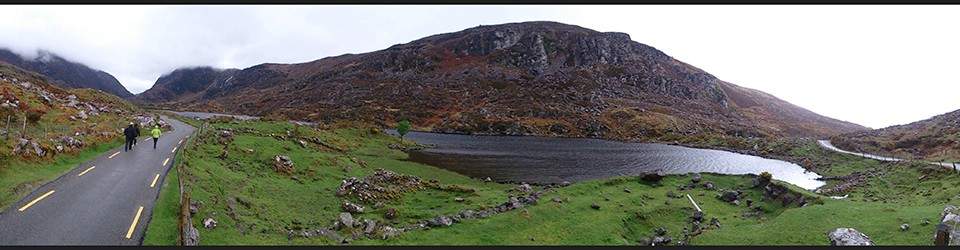
The red of the heather and the green of the grass and rushes made the landscape really vibrant.  Bret commented at one point that he felt like everything he was seeing was in the vivid mode (my favorite camera setting).

The white dots everywhere are sheep, by the way.  It turns out that our whole hike (and most other hiking in the area) was on private land.  The farmers just allow folks access.  Our hosts related that some farmers are more friendly about it than others (for instance, if you bring a dog which is only rarely allowed, some farmer will just shoot them).  I can’t even imagine how this would work in the US.  I am guessing that lots of ankles get twisted coming down those hills and those are some steep cliffs with only good sense to protect you from falling over the edge. However, the sheep generally keep to themselves, so I don’t think it bothers them too much to have hikers milling around.

IMG_2382

All in all it was a fantastic (but very wet) day.  We got just enough glimpses of the incredible views that we were missing from the clouds, that we have already put this hike back on our to-do list for when the weather gets better.

My favorite picture from the day….  ghost sheep.

IMG_2398